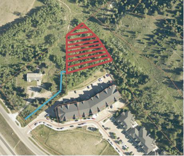
Parks and Pathways

There are 33 playgrounds in the Town of Canmore. When playgrounds reach the end of their lifespan and are ready for replacement, we look to the community to help choose the new design. Our team will evaluate proposals against a set of criteria and then let the community choose the winning design from the ones that have met the criteria.


This page will be updated with a link to vote and playground location when an opportunity is open.

The Bow River Pathway between the Rundle Drive Bow River bridge and the Homesteads Van Horne connection is an existing shared use gravel pathway, serving a critical role in the active modes network south of the Bow River. This project focused on improvements that increase safety for all users on a year-round basis, allowing for multi-modal connections to the Town Centre to be maintained throughout the winter.

Construction Impacts & Project Updates - Updated Jan. 8, 2024

  • The pathway is now fully open for the public to enjoy!

What we accomplished as part of this project:

  1. Realignment of the existing 5 metre path through west Canmore park and replacement of the prospect bridge at Canmore creek,
  2. Addressing poor sightlines and excessive grades immediately south of the junction along the Prospect emergency access,
  3. Addressing narrow facilities (establishing an approximate 3.5 metre standard width), excessive grades, and replacement of the Homesteads stormwater outfall bridge,
  4. Realignment of the southernmost section to move the pathway back from the riverbank and to eliminate side slopes,
  5. Paving of the pathway;
  6. Provide a key multi-use connection from Three Sisters into the Town Centre that we maintain year-round.

To read the full concept design report which aims to establish a facility design which enables year-round maintenance, ensures adequate width and eventual separated facilities, click here (24.34 MB).


Frequently Asked Questions

What is the updated budget for the project?

The updated project budget is $3.6M. The updated budget reflects current market conditions and is based on awarded project with successful contractor. 

The project is grant funded from the following sources:

Government of Alberta Municipal Sustainability Initiative
Canada Community Building Fund

Why are you doing this project?

This path is a key route in the Town of Canmore active transportation network, identified for future improvements in the Integrated Transportation Plan.

The most effective way to encourage active modes and increase active mode share is by supplying a safe, well-connected, continuous, and intuitive network that allows for convenient and direct travel and short trip times between desired origins and destinations. 

You find more information on the project by watching the March 15 presentation to council (starts at 3:08:42) on Youtube

I am worried about the speeds cyclists travel on trails, won't this make it worse?

No. By widening pathway networks, improving sightlines and removing steep grades, all users will be able to use the network comfortably. 

Why make the path wider?

Widening the path to 3.5m will provide a safer and more comfortable experience for people walking, cycling, and using other mobility aids. This section of path was identified in the 2018 ITP for improvement to a multi-use-path based on the travel demand in this area, and its community connectivity. Pathway width is based on best engineering practices, and as a function of the expected volumes and mix of people walking or cycling along it. Currently, the narrow width does not provide a good quality experience or high levels of comfort for the people experiencing this space. This path is well-travelled and the intent is to provide a safe and accessible pathway for everyone. 

Is pathway lighting a part of the approved project?

No, lighting is not included in the approved project scope. 

Questions

If you have a question not answered above, please fill out the Contact Engineering Form and a member of the Engineering team will respond to you.